
Our Welsh heritage

Eryri / Snowdonia

Explore the landscape, history and cultural identity behind the name Eryri, a place deeply rooted in the heritage of North Wales.

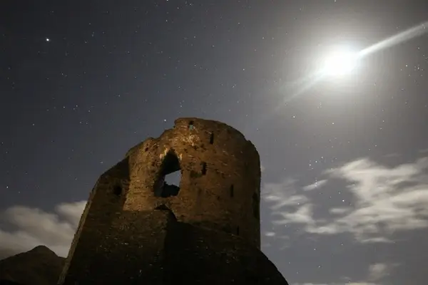
Castell Dolbadarn beneath a moonlit sky in Eryri
Castell Dolbadarn, Llanberis
THE LAND AND ITS NAME

What does Eryri mean?

The original page introduces the name, geography and history of the region.

Eryri and Snowdonia

The English-language name Snowdonia comes from Snowdon, the highest mountain in Wales, which rises to approximately 3,560 feet (1,085 metres). The Welsh name for the region is Eryri.

One familiar explanation connects Eryri to the Welsh word eryr, meaning eagle, giving the interpretation “land of eagles”. The source page also describes a scholarly interpretation linking the name to highlands and the Latin word oriri (“to rise”), associated with the work of Sir Ifor Williams.

A name with ancient roots

The name Eryri is recorded as early as the ninth-century Historia Brittonum, in a narrative concerning the fifth-century figure Gwrtheyrn, also known as Vortigern.

In medieval Wales, Llywelyn ap Gruffudd used the title Prince of Wales and Lord of Snowdonia (Tywysog Cymru ac Arglwydd Eryri). His grandfather, Llywelyn Fawr, was also associated with the title Lord of Snowdonia.

Historic Castell Dolbadarn at night Castell Dolbadarn
HISTORIC LANDMARK

Castell Dolbadarn

The original Eryri / Snowdonia page features a photograph captioned “Castell Dolbadarn”, reflecting the region's connection to Welsh history and the landscape around Llanberis.

Discover the Llanberis area
LANDSCAPE AND GEOGRAPHY

From historic Snowdonia to the national park

Before the national park's boundaries were established, the term Snowdonia usually referred to a smaller mountainous district in northern Gwynedd around the Snowdon massif. The national park, by contrast, encompasses a much larger area reaching south into Meirionnydd.

The difference between these meanings can be seen in earlier works, including George Borrow's Wild Wales (1862), H. Carr and G. Lister's The Mountains of Snowdonia (1925), and the 1949 volume Snowdonia, edited by F. J. North. The source page notes North's discussion of provisional park boundaries extending beyond the older understanding of Snowdonia.

Traditionally, the mountain district includes Snowdon and surrounding summits, together with the Glyderau, Carneddau and Moel Siabod groups. It does not extend to the hills south of Maentwrog.

As Eryri, the landscape holds a distinctive position in Welsh history, traditions and culture.

LOCAL RESOURCE

Llanberis Development Group

The original page directs visitors to the Llanberis Development Group for information about the village and its surroundings.

Visit www.llanberis.org

Source acknowledgement: The historical and geographical information on Eryri Consulting's original page is credited there to Wikipedia.

Areas We Serve

North Wales & Surrounding Areas

Gwynedd | Anglesey | Conwy | Denbighshire | Flintshire | Wrexham | Bangor | Caernarfon | Llandudno | Rhyl | Mold | Bala | Blaenau Ffestiniog | Colwyn Bay | Holyhead | Amlwch | Llangefni | Menai Bridge | Llanfairpwll | Porthmadog | Pwllheli | Nefyn | Criccieth | Penygroes | Llanberis | Llanrug | Bethesda | Betws y Coed | Llanrwst | Denbigh | Ruthin | Llangollen | Dolgellau | Bethel | Llanfairfechan | Capel Curig | Penmaenmawr | Beddgelert | Abergele | Felinheli | Harlech